Ancient Ruins and Petroglyph Sites of Utah
I have put together the following map of Native American Ruins and Petroglyph sites in the state of Utah. You will see right away that there is a very tight pattern when it comes to ruins. Most of these are out of the way, and will require hiking or boating to, unless you go to major site already described.
Petroglyphs

Ancient Indian Ruin and Petroglyph Sites in Utah
Sego Canyon – These petroglyphs are located just north of Moab, and Thompson Springs off of I-70. There are several different panels all in close proximity to each other from distinctly different time periods. Even though the road to this site is dirt, it was not bad the last time I visited in 2010.
Newspaper Rock – A personal favorite, this historic monument is located between Moab and Blanding, on the southern road into Canyonlands Needles District. Its one of the most accessible and best preserved rock art panels in the West.
Moab Area – There are quite a number of small petroglyphs sites around Moab, Canyonlands and Arches National Parks. Here is the best map I have found.
9-Mile Canyon – This canyon located north east of Price, is well known for its rock art. Though I haven’t been in the area for a long time, from what I know it hasn’t been seriously impacted by the oil drilling activity in the area, but that could change at any time.
Molen Reef/Rochester Creek Panels – These are two spectacular sets of petroglyph panels located in close proximity to each other. Molen is located on the Moore Cut-off Road between Moore and I-70, Rochester is just to the west and south on a dirt road east of Emery.
Parowan Gap – This interesting landform just west of the town of Parowan (between I-15 and Highway 130) contains a variety of Indian petroglyphs visible along the roadway that travels through the Gap. There is a nice brochure about the Gap available here.
Fremont Indian State Park – Located near the junction of I-70 and I-15, this Utah State Park features rock art carved by the Fremont Indians. Please visit the Park’s website for more information.
Santa Clara River Reserve – Located between Ivins and Santa Clara, this nature reserve was setup recently to protect both the biological and archaelogical resources located within its boundaries. The majority of the petroglyphs are located on Anasazi Ridge which is southwest of Old US Highway 91. For more information, visit this BLM website.
Gunlock Reservoir Petroglyphs – If you follow the Old Spanish Trail to the Gunlock Reservoir north of Santa Clara and Saint George, you will find rock art in the hills along the road. Here is a sample of what exists in the area with a little time spent searching.
McConkie Ranch Petroglyphs – Located off Highway 191 North of Vernal, this is a private ranch that allows public visits to a spectacular set of petroglpyhs. Visit this website for more information.
Indian Ruins
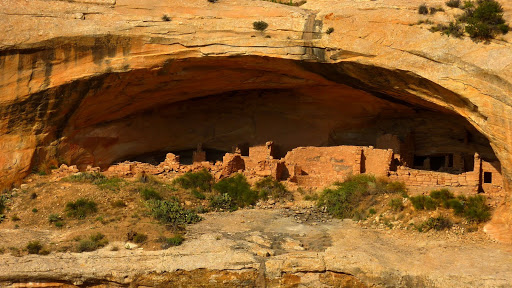
Cedar Mesa/Comb Ridge – This plateau, located in southeastern Utah between Blanding, Bluff and Natural Bridges National Monument, is home to one of the largest concentrations, as well as some of the most spectacular (Anasazi) Indian ruins in the Southwest. Unlike Hovenweep, Mesa Verde, and Chaco Canyon accessing these ruins requires a fair bit of research, and planning. Reaching them in many cases may involve long hikes, 4×4 vehicles, and/or hiring a boat.
If undertaking short to over night hike in the desert doesn’t present a problem, there are a number of possibilities available to you from major roads in the area. These include:
West Water Ruin – While not technically part of Cedar Mesa, this ruin is just outside Blanding, and very accessible if you know how to find. it. Refer to the pap I have posted above for a better idea, or you can find more details here.
Butler Wash Ruin – Compared to other cliff dwellings in the Cedar Mesa area, this one located off Highway 95 on Comb Ridge can be accessed fairly easily with only a short walk from the highway.
Mule Canyon – This canyon located off of Highway 95 offers access to a number of different ruins including a very famous one known as the “House on Fire” ruin.
Grand Gulch Primitive Area – This famous canyon, known for its ruins is located west of the Kane Gulch BLM Ranger station on Highway 261. Hikes in the Gulch can range from a few hours to days, depending how many canyons you choose to explore.
Road Canyon – Located east of Highway 261 and Grand Gulch hosts a number of Indian Ruins, including two well known ones called Fallen Roof and The Citadel. This is one of the ruins where having a high clearance vehicle will help cut down on the amount of hiking involved.
Owl/Fish Creek Canyons – Directly opposite Grand Gulch these canyon make up a single over night hiking loop that boosts numerous Indian Ruins along the canyon walls.
Monarch Cave Ruin – This cliff dwelling is located along the Lower Butler Wash Road east of Comb Ridge. Monarch Cave is one of the larger ruins, but requires driving off pavement to reach.